Van Buren County Iowa
American Guide Series
Compiled by workers of the Writers' Program
of the Work Projects Administration
in the State of Iowa
FEDERAL WORKS AGENCY
JOHN M. CARMODY, Administrator
WORK PROJECTS ADMINISTRATION
F. C. HARRINGTON, Commissioner
FLORENCE KERR , Assistant Commissioner
GEORGE J. KELLER, State Administrator
Sponsored By
The Van Buren County American Legion
page 81
of which was attached to a point near the present location of the Manning Hotel. There was little current to operate the ferry because of the dam just below Keosauqua. The ferryman had to use ferry a rope in addition to the cable and frequently called upon his sturdiest passengers to help pull the ferry across the river. At Pittsburg there was a strong current that at times carried the boat across in two minutes. At Keosauqua, there was also a small car attached to the ferry cable by a set of pulleys. Two or three could ride across the river. in this car, which crossed the river more than half way by gravity, and was pulled on the cable the rest of the way. In December, 1869, when the ferry was not operating, George Weiny took a ride across the river in a basket hung from the cable high in the air. He had ridden on horseback to Pleasant Hill, expecting to cross on the ferry and secure his marriage license. He took a real 'sky ride" across the river.
In 1850, the little village of Pleasant Hill, now a part of Keosauqua, was established across the river by John Purdom. At one time Pleasant Hill had a hundred inhabitants, a hotel, a blacksmith shop, a store, a school house, and a church.
In 1851 interest in an agricultural fair was revived, and a fair was held at Keosauqua An old settlers' meeting was featured, and horse raring provided entertainment.
In 1851 Rev. Daniel Lane opened his first academy in Keosauqua in the basement of the Odd Fellow's Building; he closed it after two years to serve as Principal of the Preparatory department of Iowa College at Davenport, but returned in 1859 to re-open the academy in the basement of the old Methodist Church. The Civil War brought a slump in attendance and forced the school to close.
In 1854 J. H. Mayne established the Keosauqua Republican, which is still published. Not long after this weekly newspaper was started, it was purchased by Oliver J. Taylor, the first husband of Rebecca Pollard. The next publisher. George T. Henry, kept the paper going through the Civil War. Joshua Sloan became the next publisher, and acquired John W. Rowley as a partner in the late 1880's. Later, J. H. Landis bought the Sloan interest; and a few years ago H. B. Carroll acquired control. At present R. W. Winslow is the owner, having bought Carroll out in 1939.
Another newspaper, the Independent, was published in Keosauqua from about 1912 to 1920, first by the Sherman brothers, Boland and Sidney, and later by Roberts and Duckworth.
In 1877 the Van Buren Democrat was moved from Bonaparte to Keosauqua, and later the title of the paper was changed to State Line Democrat. Smith continued as owner until his death in 1921. His widow managed the paper for a year, and after her death it was taken over by A. G. Roberts of Bonaparte who changed its name to the Van Boren Barometer. In 1928 it was absorbed by the Van Buren Record.
page 82
About 1854 the state began to make improvements along the river and built a lock and part of a dam at Keosauqua (see Des Moines River Navigation, History of Van Buren County). In 1857 an ice gorge knocked the mills from their foundations, causing them to float down the river. After this the state made no more river improvements at Keosauqua.
During the 1860's Keosauqua had a glee club of ten members. In 1892 the club held a reunion with all but one member present. In 1925 half of the club members were still alive.
In 1865, Keosauqua's first independent district school, costing $18,500, was erected It was a three-story brick building.
About four hundred and fifty Negroes were living in Keosauqua at the close of the Civil War. They lived on a hill near which, in a hollow back of the jail, there had been a station on the Underground Railroad. On Thanksgiving Day they always gathered for a big Thanksgiving dinner at one of the churches or someone's house, and on Emancipation Day, January 1, they generally had an Emancipation supper.
In later years, most of the Negroes moved to other parts of the state. Only a few Negro families have remained in Keosauqua (see Negroes in Van Buren County, History of Van Buren County).
The Keosauqua monument to the Van Buren County men who died in the Civil War was dedicated in 1868, It stands in the park area opposite the courthouse. A shaft monument with a finial urn was built by public subscription, and is engraved with the names of those who died in the war.
The Opera House was opened with a grand festival in 1876. Many road shows later played there. On the second floor of the Opera House were the Masonic rooms.
Early in 1880, Johnson and Wilson purchased the old United Presbyterian Building in the upper part of Keosauqua and turned it into a hoop factory. In December of 1884 a chapter of the P. E. O. was organized, and in 1888 the chapter entertained the Grand Chapter, and launched the P. E. O. Record, the official paper of the organization.
In 1895 the Keosauqua school house was remodeled. The Manning Hotel, part of the Manning' brick block, was erected on the Des Moines River bank in 1898. It was built from bricks moulded on the Myers land adjoining the town. One end of this block was arranged for a public library.
Keosauqua was one of the hardest hit towns in the Des Moines River floods of 1903 and 1905 (see History of Van Buren County).
The Manning and the Jackson brick blocks were destroyed in 1898 by one of the worst fires in the history of the town. Property damage amounted to $35,000.
The Black Hawk Medicine Company, incorporated in Keosauqua in 1908, remained in business until 1912, when its Articles of Incor-
page 83
poration were canceled. All of its products were known by the trade name, Black Hawk, and its most famous medicine, the Algire Kidney Cure, was made from Iowa herbs,
In 1910 the Ladies Improvement Society erected the first public library building. In 1916 an auditorium was added to the library at a cost of $1,800. In 1923 a kitchen was built adjoining the library.
In 1919 the State Board of Conservation inspected the country along Ely's Ford Creek, south of Keosauqua (see Points of Interest). The region was thick with natural shrubs and was already being used as a recreation ground. Ely's Ford, on the Des Moines, beneath rocky cliff, had long been a landmark in the vicinity. It was named for the Ely homestead that stood on the river bank. The river had a rocky bottom at this point, and farmers had driven their teams across the river here before the days of bridges. In those days the youngsters of Keosauqua wandered down the road to Ely's Ford and begged a ride across the river in one of the farm wagons. They liked to see the horses splashing belly-deep through the water that sometimes reached the wagon box. Sometimes, though, the boys had to wait hours before they got a ride back across the river.
The State Board also inspected the area surrounding Big Duck Pond near Farmington, and in September, 1919 both areas, more than twelve hundred acres, were acquired at an average cost of $50 per acre. Citizens of Van Buren County contributed $7,600. The park, named the Lacey-Keosauqua Park, was dedicated in 1920.
There was talk of oil and oil wells during the early part of 1924, and one day three flat cars heavily loaded with machinery for sinking a test shaft arrived in town, billed to the S. W. Manning Farm north of Pittsburg Lane. A derrick, able to sink a shaft three-fourths of a mile, was in place on Sunday, June 8. In the afternoon a crowd gathered to see the "spudding in," the first real drilling for oil ever attempted in southeastern Iowa. Several months later, on another Sunday, it was announced by the group in charge that Keosauqua's 850-ft. deep hole in the ground was a real oil well. The news attracted people from all parts of the county, and most of them carried home a bottle of crude oil. The well was formerly dedicated as Manning No. 1: but when the well was "shot" there was no gusher, nor even a paying well.
A creamery, built in Keosauqua in 1924. is one of the largest in the State. A new two-story high school was finished and dedicated in 1925.
In 1931 the Keosauqua State bank closed, leaving the city without a bank.
In 1935, Honey Creek broke through the levee and flooded several streets. Boats sailed along the stints until the receded.
POINTS OF INTEREST IN VICINITY
1. COURTHOUSE. VAN BUREN COUNTY (on the north side
page 84
of Courthouse Park, facing Court Street). Standing on a hill overlooking the Des Moines River, this old two-story brick courthouse has been in continuous use since 1842. It is the oldest structure of its kind in the state and has never been remodeled. The sheriff's and the county superintendent's offices and the jury room occupy the first floor. The courtroom is on the second.
Although other settlements in the county endeavored to have their town chosen as the seat of Van Buren County, Keosauqua was named in 1841 (see Organization, History of Van Buren County). Construction of the courthouse was begun in that year, but the building was not finished until 1843. At that time the Van Buren County Courthouse was one of the larger structures west of the Mississippi.
Its first-story walls are twenty-two inches thick; those on the second floor, eighteen inches. The supporting timbers and frame work are of oak. Native walnut, used in finishing the interior of the structure, was taken from trees hewn within one hundred rods of the courthouse site. The walls are still in excellent condition.
The courtroom on the second floor, completed under the direction of Judge J. C. Knapp in 1851, was for many years the largest in the state unbroken by columns or pillars. It has remained practically unchanged for more than three generations. A double door opens into the large chamber, which is divided into two sections by an iron grille near the center of the room, separating the spectators' benches from the court proper. The grille, three feet high and made up of half-inch metal bars, is an interesting addition to the room because of its unusualness in such a setting, wood being the usual material for such partitions. Pictures, many dating back over a long period of years, of judges who have served the court, hang on the walls of the chamber.
In the attic, reached by ladder from the second-story hallway, is housed the gallows upon which was hanged the only person (nee Hangman's Hollow) ever sentenced to death in Van Buren County.
2. HANGMAN'S HOLLOW (small, picturesque valley one block north of the courthouse, near the jailyard at Keosauqua, and near the intersection of Division and Fourth Sts.). On April 4, i846; the only person to be legally executed in Van Buren County was hanged from a gallows erected on a mound in this natural ampitheater, which has since been called Hangman's Hollow. Scores of persons gathered on the surrounding slopes to watch Captain J. H. Bonney, then sheriff, supervise the hanging of William McCauley who had been found guilty of murdering Don Ferdinand Coffman.
Although the affair took place in Washington County. a chance of venue placed the case on the Van Buren County docket. Coffman was shot from ambush while he and his wife were passing a corn field. Coffman was holding his infant daughter in his arms, and both were fatally wounded. The shooting climaxed a quarrel be-
page 85
tween McCauley and Coffman, Coffman having accused McCauley of being too familiar with Mrs. Coffman. At his second trial, McCauley confessed the shooting, but stated that Coffman had threatened his life. According to the accepted story, Coffman discovered his wife's plans to elope with McCauley and persuaded her to stay for the sake of the children. The two, with the infant daughter, were on their way to tell McCauley of Mrs. Coffman's decision when Coffman was shot.
His body was interred in Oak Lawn cemetery, but there are those who say that several nights later McCauley's body was removed from the grave, the bones cleaned, and the skeleton wired together and kept in the office of Dr. Fitch of Pittsburg.
The gallows, erected at a cost of $9, was taken down following the execution and removed to the attic of the courthouse.
3. OLD HOUSES. Bonnyview, the oldest frame house, and the Pearson home, the oldest stone brick dwelling in Keosauqua, were built within a year of each other, the latter residence slightly antedating Bonnyview, which was built in 1839.
The Pearson home, Pittsburg Road, two blocks northwest of the Courthouse, was a station on the Underground Railroad. The house, of modified Georgian design, lacks the front portico that usually adorns a home of this style. It stands on slightly rising ground in a yard where several large cedar and locust trees grow. It has single-paned, double-hung windows instead of casement windows; the first story is of native rough limestone and the second of brick. Wide double chimneys emerge from each end of the building, and there is an outside stairway to the second floor, a reminder of the days when the entire upper story was one large room, used for religious services before churches were erected.
The central part of Bonnyview, named by Estelle Bonney Walker, the present owner of the house, is the original house erected by William Hadden, and consists of three rooms downstairs and two upstairs. The part toward town was added to this structure in 1856, and porches and additional upstairs rooms were added later. Bonnyview is typical of many Iowa homes built in pioneer days. It has a large open porch, straight, almost severe lines, and a centrally located chimney.
4. LACEY-KEOSAUQUA STATE PARK (short distance southwest of Keosauqua; S. on State 1 to its junction with park road at the outskirts of the town; R, on the park road), The largest and second oldest state-owned reserve, Lacey-Keosauqua State Park, comprising 2,210 acres, mostly woodland, lies facing the curved tip of a large horseshoe bend on the Des Moines River. It was named for Major John F. Lacey, an ardent conservationist. Tree-covered hills with plant under-growth, rugged ledges, open meadows, a lake, and the majestic sweep of the river add variety and enchantment to the
page 86
region. Marked trails traverse the park. The state uses the area as a sanctuary, and many forms of plant, animal and bird life are prevalent.
A picnic ground, with fireplaces and two large shelter houses made of rock, has been laid out on a bluff overlooking the river. Three miles within the park is a stone lodge, with steam heat and running water and accommodations for about eighty people. Meals and banquets may, be held here; groups must make arrangements for special accommodations. Rustic bridges, benches and tables made from native walnut and oak trees harmonize with the atmosphere of the park.
There is a nine-hole golf course with grass greens and natural hazards (fee, see Places to Play). The thirty-five acre artificially-dammed lake offers swimming and boating facilities, also fishing in season.
5. ELY FORD MOUNDS (near Ely's Ford on the Des Moines River, in Lacey-Keosauqua Park, southwest of Keosauqua on State 1). First opened in 1878. handiwork and remains of a pre-historic race (apparently not historic American Indian) were found in these mounds, which extend along the river bank. The finds included pottery, arrow heads, bones of animals, part of a skeleton, a human skull, leg bones, thigh bones, and two well-preserved human skeletons.
6. U. S. FORESTRY SERVICE NURSERY (.5 mi. E. of Keosauqua on a bank of the Des Moines River). The thousands of trees being grown at this government nursery, established upon a 100-acre plot of land in 1935, are to he used in soil erosion and reforestation projects.
The seedlings, arranged in rows four inches apart, each six rows constituting a bed, each bed 224 feet long, are watered by means of an overhead conduit system. Some of the varieties of trees under cultivation are black locust, pine, Osage orange, elm, ash, soft maple. hard maple, basswood, hickory and sumac. For a nominal fee individuals may arrange for the transplanting of selected trees on farms or residential sites.
7. PITTSBURG (west from the junction of State 1 and a County road in Keosauqua locally known as the Long Lane. about 1.5 m.). Pittsburg. now a tiny village without a post office, is practically a suburb of Keosauqua. It provides much of the setting for The Long Lane, a novel by Phil Stong, who is the owner of the farm at the edge of the village upon which the Church Tree stands (see The Old Church Tree).
Pittsburg, first known as Rising Sun, was laid out in 1839 by Ephriam Warner, A. R. Williams and John Groom. Settlers were, already in the vicinity, and Samuel Clayton had erected a flour mill there in 1836. In 1854 William Funk erected a steam mill, and the
page 87
distillery that Funk built in 1863 still stands on the river bank just below the bridge. The old three-story building is in good condition with the sills and joists as solid as when they were placed, The beams are locked in place with heavy oak pins. People in the vicinity still have, as souvenirs, some of the handmade bolts and taps that Funk made to hold the copper bands in place around the oak vats. He carved the entire threads; on the bolts and taps with an awl. The bonding house where the liquor was labeled and stored is still standing just north of the distillery.
An Erv Wilson ran a saloon in the town and ran it so well that wives couldn't keep their husbands at home. The ladies went into action one afternoon after they had gathered to discuss the matter. Clapping on their bonnets and draping their shawls about their shoulders, they hurried to the saloon, gathering clubs, big sticks, and other weapons enroute. Without a word of warning they entered the saloon and began to wield their weapons, Unprepared, the men scrambled to safety, the owner of the saloon grabbing his coat and hat and disappearing for good. When the women finished, the whisky and gin were in a puddle on the floor. No chairs, no bottles, no glasses remained unbroken. Even the bar lay toppled over. Since that day there has been no saloon in Pittsburg.
8. THE OLD CHURCH TREE (on west bank of the Des Moines River, .25 m. N. of Pittsburg, about .25 m. above the mouth of Chequest Creek on the Linwood Farm; owned by Phil Stong, author). Under this old elm, settlers came together in August, 1837 for the first general religious meeting in Van Buren County. The tree, large at even that time, stood at the foot of a slope on the Des Moines River at a point where people often forded the stream. Almost a hundred congregated to hear the Reverend Hill, a Baptist minister, preach his hell-fire sermon.
One who attended that meeting remarked many years later, "I seldom pass that elm to this day, but that I unconsciously look at its roots as I did that day at Mr. Hill's direction when he screamed: 'Oh, sinner, look!' (bending with hands nearly to the ground) 'while I take off the hatch of hell! . . ' He did this after so arranging matters that I was sure the young people in general, and I in particular, were but a few inches above the rotten ridge pole of the burning pit. What a relief it was when he quit."
On the fringes of the crowd, with blankets about their shoulders, were Indians, among them, it is said, Black Hawk, deposed chief of the Sac and Fox Indians (see Selma, Points of Interest). Hard Fish, the new chief, had his village not far away. It was not the first time that the old tree had been used for a meeting place, for the bands of Black Hawk and Keokuk had gathered beneath its spreading branches for their pow wows, ceremonies, and races. The marker on the tree was placed there by Mr. B. J. Stong, Phil Stong's father.
page 88
9. POINT MILITARY ROAD (at junction of State 1 and State 3, ch mi. SW. of Keosauqua). In August, 1937 the D. A. R. of Van Buren County erected the fifth marker constructed in the state, to indicate the route of the old Military Highway through Van Buren County. The marker was placed in a triangle of landscaped ground, now surrounded by pavement. This Military Road, built during the boundary dispute between Missouri and Iowa, was the first regular road north and south across the state. In March, 1839, the United States Congress appropriated $20,000 to build the road, which was "to begin at Dubuque and run to such a point on the northern boundary of the state of Missouri, as may best be suited for its future extension by that state to the cities of Jefferson and St. Louis." The road entered Van Buren County from Mt. Pleasant, then followed a route that led through Winchester, Keosauqua, and southeast to the border. The present highway does not follow the old route closely. From the site of the monument, however, State 3, going south, follows the old Military Trail for about two miles. The purpose of the road was, "Not only a means of travel, but to afford travelers and settlers protection from possible Indian attacks, so that troops could be quickly moved from one part of the territory to the other."
page 89
Milton
population: 771; Platted: 1851; Railroad: C. B. & Q.; Highway: State 3, 23; Churches: Methodist Episcopal, Presbyterian Christian, Nazarene; Schools: Grade and High Schools; Newspaper: The Milton Herald; Theatre: Several times weekly; Legion Post: Russel Post, No. 483.
Milton, one of Van Buren's younger towns, is now the third largest in the county. The C. B. & Q. railroad, running through the center of the town, cuts across the block-and-a-half business district. Along Main Street there are grocery stores, gas stations, poultry and feed stores, beauty shops, a jewelry store, a theatre, dentist's and doctor's offices, a dry goods store, a furniture store, and other shops.
The business district, in the heart of town, is surrounded by well-kept residential sections.
Dr. Logan Wallace settled on the site of Milton in 1847, and the town was laid out in 1851. Allen Casady came to the vicinity with his father in 1837. In the winter, thirteen settlers stayed in the "double shanty" his father built. The oldest building in the county now stands on the Casady farm.
There were settlers in the vicinity of Milton as early as 1840. J. W. Holland and a friend came from Sussex, Delaware about this time, and selected 360 acres, part of which is now Milton. A school was set up in the early 1840's, and the Methodist society was organized. The town developed like many other cross-roads villages.
A 1,000-acre sheep ranch was established southeast of Milton in 1848 to raise wool for the Meek Woolen Mills at Bonaparte (see Bonaparte).
A corn cracker and sawmill was built by C. Miller in 1852, and a Community Fourth of July celebration was held here in 1854. Be-cause the local mills were small ones, some of the settlers patronized the larger mills on the Des Moines River. These trips then took two days. Room was provided for the farmers to stay overnight; but they had to use their own blankets. One bushel in eight was paid as toll.
In 1856 Garrett Thompson killed Charles Brewer in a fight. Thompson haad dunned Brewer for a debt and Brewer, angered, was following Thompson, when Thompson turned and shot him. Thompson claimed self defense, but was sentenced to a term in prison. He was pardoned after he had served six months. A few years later, he was hanged in Monroe County for horse-stealing.
The Baptists erected a new church in 1866. A larger schoolhouse was built in 1867. The Feath carriage factory was established in 1872 and its wagons soon became known all over the Middle West. In 1872 the Burlington and Southwestern railroad was extended to
page 90
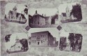 Milton
[click to view]
Milton -- Reading from left to right, Christian Church (still in use), Old School House (replaced in 1927-28), Old Methodist Church (burned and replaced), Baptist Church (now Nazarene Church), Theatre (still in use), Presbyterian Church (still in use).
Milton
[click to view]
Milton -- Reading from left to right, Christian Church (still in use), Old School House (replaced in 1927-28), Old Methodist Church (burned and replaced), Baptist Church (now Nazarene Church), Theatre (still in use), Presbyterian Church (still in use).
page 91
Milton. In 1873 a flour mill was established by C. Miller. A saloon was opened in 1875, but the women of the town set fire to it and it was not reopened.
In 1878 Milton was incorporated, and the Milton Herald was started in the early 1880's by Harold Dysart who edited the paper for many years. He was succeeded by' Mr. Guernsey, who edited the paper until 1932, when it was taken over by a newspaper chain. In 1881, the Milton Agricultural Society held its first exhibition, the Milton District Fair. The fair was an annual event until 1923.
Milton was a veritable Hamelin at one time during the 1880's. Rats overran the town ranging through stores, running along the rafters in houses, keeping families awake all night, and slinking through the streets even in daytime. After several people had been bitten by rats, the citizens held a meeting, at which the mayor proclaimed the next day as Rat Day.
There was more commotion and excitement on Rat Day than the town has known since. Boxes and barrels were moved and dumped. Floors of old barns were ripped up, and rats were swatted right and left. No corner in Milton was left untouched. Rats began to pile up at headquarters, where two teams, combing the town, reported with their latest "take." At noon, everyone took time off for lunch. Then the rat hunt went on. Cats and dogs joined the human hunters. Nests were destroyed, refuse burned. By 5:30 it didn't seem that a rat was left alive. More than five thousand dead rats, piled into a dray with high side boards, were paraded through the streets.
During the 1890's there was plenty of game in the county. Rabbits were selling for 60c a dozen; quails for $1.00 a dozen; jack rabbits for $4.00 a dozen; prairie chickens for $2.50 a dozen; mallard for $2.00 a dozen; and teal for $1.25 per dozen. Bear meat was 12 1/2c to 16c a pound; wild turkey 8c to 10c per pound; antelope, 10c to 13c per pound; deer, 10c to 12c a pound; oppossum, each 25c; coon, each 50c to 75c.
In 1892, the town paper bragged, "Milton is the only town in southern Iowa that has no old maids. It speaks well for the town."
It was a common thing after 1893 to see farmers with loads of wood enroute to the ax handle factory in Milton. The factory, one of the most promising of the manufacturing concerns, was owned and run by P. G. Carder. Sometimes he bought a stand of trees and sent his own crew to fell the timber and prepare it for milling. At one time the factory's output was three hundred ax handles a day. Each handle was shaped by hand and the owner and the factory manager worked side by side with the other employees.
The Presbyterian Church, an Opera House. a department store, a general store, a power house, many other businesses, and one hundred residences were erected in the early 1900's. A gas plant was set up in 1903. A new brick yard was established in 1904. In 1907, fire destroyed the old flouring mill, an ice house, grain house,
page 92
and a creamery; but two years later six commercial establishments and six residences were constructed, and many new barns were built in the surrounding farm territory.
Another fire in 1912 destroyed $50,000 worth of property. A few years later, Milton installed a water works system.
In 1927 a new Methodist Church was built. In 1928 a new public school was erected. In 1938, the town theatre, built in 1911, was remodeled.
page 93
Mt. Sterling
Population: 165; Railroad: C. B. & Q. Highway: Gravel County Road 3.25 m. S. of junction of State 3 and 1.
Mt. Sterling is on the side of a hill overlooking the Fox River. Approached from the north, the town is not visible until the hilltop above the town is reached. From this point the scattered dwellings, the grade school, the old frame church, and a few stores can be seen.
The tiny village, laid out in 1839 by Horace and George Wood was known for a time as "Dogtown." The Woods had built a corn-cracker and a sawmill near the townsite. Horace Wood had three hound dogs, and most of the men who came to the mill had two or three dogs with them.
One day a stranger rode into the settlement in the midst of a dog fight. "What town is this?" he asked.
The men who were standing around watching the dog fight answered, "It hasn't any name."
"Well," said the stranger, looking at the dogs fighting, "it ought to be Dogtown."
It was some time before the people of the town succeeded in getting its name changed to Mt. Sterling.
Dr. Joel Knight, the first physician, put up his bark tent in what was afterwards Thatcher's Pasture. His specialty was Dr. Joel Knight's celebrated Screw Augur Pills, a cure for all diseases, one hundred pills for a dollar.
Stories are still told about the Wood brothers. Horace once refused to let a man have a meal when he offered to pay for it, and gave a meal to a man who had no money at all. Peter eloped with another man's wife and was greatly disconcerted when his own wife followed him. He finally gave a friend lands valued at $200 to take his first wife off his hands.
For a short time, Mt. Sterling had flour and saw mills, a distillery, a barrel hoop manufactory, and a wagon shop. None of these remained open long.
The only church in Mt. Sterling was built in 1870 through the joint efforts of the Methodist and United Presbyterians. Other denominations held services in homes, but none erected churches.
From 1841 to 1851, school was taught in a number of places in and near the settlement. A log school, erected on the site of the present building, caught fire while the school boys played poker. it is said, and was burned to the ground. The frame school erected in 1861 is still in use.
page 94
Mt. Zion
Population: 90 (1911). Railroad: C. R. I. & P.; Highway; State 1: Church: Presbyterian.
All that remains of Mt. Zion is a store, a hotel, the Presbyterian Church, a few dwellings, and the depot. The children in the village attend the district school one mile north.
Mt. Zion, first called Summit and laid out in 1860 by John and Alexander Taylor, lies one-half mile west of the Des Moines River, almost in the center of the county.
When the Keokuk, Fort Des Moines, and Minneapolis Railroad was being built through the town in 1860, Mike Welch, and Irishman, almost chopped off the head of Malachy Curry. with whom he had been working on the railroad. Welch sentenced to prison for twenty-five years; after serving five years, he became insane and was transferred to the Insane Asylum, where he died.
The first train arrived in Mt. Zion on September 14. 1860.
For a time. the K. D. & M. Railroad crossed two 80-foot trestles, but after a trainload of cattle fell from, one of the trestles, the route over the high spans was abandoned. The railroad now runs to the west, around bluffs, toward the river.
When the railroad was built through the town, the people of the vicinity, mostly Presbyterians, withdrew their church membership from Birmingham, and organized a mission church in Mt. Zion. Reverend Sharon was the first pastor. The church, built in the early 1860's, was used until 1903, when the present church was erected.
POINTS OF INTEREST IN VICINITY
I. KILBOURNE (1 m. N. on State 1 to junction with County Road; L. on County Road about 3 m.), is the Brunswick of Phil Stong's novel, State Fair. The actual village has only a crossroads store and a few houses.
According to State Fair, "Brunswick lay on the banks of the Des Moines River, seven miles from Pittsville, the county seat .... The planks of the old Brunswick bridge rattled under the little car. They heard the low lifting and falling swell of the river against the piers as they drove on toward the formidable curtain of green blackness at its far approach."
During the summer of 1932, after movie rights to the book had been sold, Hollywood cameramen invaded this vicinity and took shots of the hills, valleys and roads that later furnished the movie background for the journey of the Frake family to the State Fair. The late Will Rogers played the part of Mr. Frake.
Another portion of the novel tells of the family's journey home after both Mr. and Mrs. Frake had won prizes at the State Fair, Margy, the daughter, looking at the river at Des Moines says, "It's only a small reiver here . . . . At Brunswick it's big, mysterious . . . "
page 95
At last the family was nearly home. "Ottumwa went home from the movies and Able drove on toward Eldon. After Eldon he would drive the river road, down past Selma, Douds, and Brunswick, beside waters that would lick at the edge of his farm hours later. He liked the river. It made him think of Indians, and the Church Tree -- the great elm under which his grandfather had arranged the first religious services ever held in that part of Iowa -- and of things no old and enduring that they didn't even disquiet his mortality."
Kilbourne, almost deserted, lies in a valley surrounded by wooded hillsides. In the vicinity, where Lick Creek empties into the Des Moines, there were once forests well stocked with game. Indians hunted here, and many stone axes and arrow heads still are found in the valley. The Indians loved the river valley at this point, and tradition says that one noted warrior asked to be buried near the river no he could see the canoes coming up the stream. He was buried by his tribesmen in a sitting position facing the river, his head above the ground, on the south bank of the Des Moines, just a little above Kilbourne.
Although the village site was encircled by natural forests during the years the Indians roamed here, there was an open piece of ground, almost treeless, a short distance up Lick Creek. Here the Indians held horse races and played games. According to tales told by early pioneers, it was in this natural arena, not far from Iowaville, that a Sac and Fox war party fought a decisive battle with the lowas, leaving only a handful of the tribe that earlier had ruled the Des Moines Valley (see Indian History, History of Van Buren County).
There was a settlement here as early as 1834. When government surveyors reached the territory in 1837 they found a tiny hamlet, which John Platchett platted two years later as Philadelphia. The government surveyors ran a line across the Horse Shoe Bend of the Des Moines River opposite the mouth of Big Lick Creek, locating what is now the eastern boundary of Kilbourne. They laid out the surrounding land from a cornerstone that they established forty rods beyond the town. The town was named for David W. Kilbourne of Keokuk, one of the organizers and once vice president of the Keokuk, Ft. Des Moines, and Minneapolis Railroad Company.
page 96
Selma
Population: 125 (Iowa School Census); Platted: about 1851. Railroad: C. R. I. & P.; Churches: Methodist Episcopal, Presbyterian; Highway: State 98; Des Moines River Bridge: 1901.
Selma is a small Des Moines River village. In the late winter of 1934, snow storms, thaws, and rains, as they had so often done before, made the streets nearly impassable; but this time the town council offered to furnish the materials for new streets if the townspeople would supply the labor and the equipment. On February 2, 1934, fifty men and eighteen teams hauled and spread 175 loads of sand from the Walker Baker farm. A few days later, seventy men and twenty teams hauled and spread 200 loads of gravel. A third day's work finished the job.
Selma, first named Independent, was also popularly known as "Stumptown," probably for George Stump who kept the first store and was the first postmaster.
The postoffice was established in 1858, when the town was named Hickory.
In 1835 Thomas Benjamin Saylor built the house now known as the old Hinkle Home, and believed to be the oldest in southeastern Iowa. Saylor hewed the timbers by hand, fitted them, and made the pegs, taking a year to complete the house. This was before white settlers were legally allowed in the territory. After he left Selma the house was resold several times. Saylor went to Des Moines, Iowa, where a school, and the nearby village of Saylorville, are named for him. In 1868 the house he built was sold at public auction to Captain Abraham Hinkle, an officer in the Governor's Guards in Virginia, who had fought with the North in the Civil War. Miss Lora Hinkle made the home into a historical museum.
William Monroe taught in the first log school house, built in 1852. A frame school was erected in 1865. A steam saw mill was started by John M. Walker in 1867 and a steam grist mill was started by G. W. Elerick & Co. in 1868. The first church (Methodist Episcopal) was erected in 1869.
W. E. Downing operated the ferry at Selma. One day in May, 1888, the swift current tore up the cable post on the shore. leaving the boat stranded in the middle of the Des Moines. Before the boat could be pulled bark to shore, a large tree crashed into it and split it in two. The fifteen men aboard, practically the entire population of Selma, were flung into the river. All, however. were saved.
In 1925, wolves and foxes in the neighborhood broke into the farmers' barnyards so often that a hunt for them was begun over a large area. One thousand men are said to have participated in the hunt, but only two wolves and a fox were bagged.
Two miles to the meet of Selma is the Jollies Jordan Farm,
page 97
 Hinkle Log Cabin, Selma
[click to view]
where Chief Black Hawk was first buried (see lowaville).
About 8 miles east of Selma is the Bethel Church Cemetery (see Grave of Mrs. Rutledge, Birmingham).
POINTS OF INTEREST IN VICINITY
1. OLD LOG CABIN AND PIANO (near Selma on estate of late Miss Laura Hinkle, bordering State 98). The Old Square Piano that belonged to Miss Laura Hinkle's mother stands in a Log Cabin on the Hinkle estate. In 1849 Miss Hinkle's grandfather, James Jordan of Iowaville, ordered the piano from a Boston firm and paid $1,000 for it. The instrument, a gift for Miss Hinkle's mother, arrived at the Jordan home by railroad, wagon, and ox team.
2. IOWAVILLE, SITE OF BLACK HAWK'S LAST LODGE AND CHIEF VILLAGE OF IOWA INDIANS (on State 98, northwestern corner of Van Buren County). Iowaville, a tiny hamlet two houses, was once the busy village where Chief Black Hawk spent his last days. In the 1860's there were about two hundred inhabitants. The village site on the Des Moines River was purchased from the Indians in 1837 and platted the same year. Black Hawk died at Iowaville in 1838 and was buried on the James Jordan farm, two miles west of Selma.
Hinkle Log Cabin, Selma
[click to view]
where Chief Black Hawk was first buried (see lowaville).
About 8 miles east of Selma is the Bethel Church Cemetery (see Grave of Mrs. Rutledge, Birmingham).
POINTS OF INTEREST IN VICINITY
1. OLD LOG CABIN AND PIANO (near Selma on estate of late Miss Laura Hinkle, bordering State 98). The Old Square Piano that belonged to Miss Laura Hinkle's mother stands in a Log Cabin on the Hinkle estate. In 1849 Miss Hinkle's grandfather, James Jordan of Iowaville, ordered the piano from a Boston firm and paid $1,000 for it. The instrument, a gift for Miss Hinkle's mother, arrived at the Jordan home by railroad, wagon, and ox team.
2. IOWAVILLE, SITE OF BLACK HAWK'S LAST LODGE AND CHIEF VILLAGE OF IOWA INDIANS (on State 98, northwestern corner of Van Buren County). Iowaville, a tiny hamlet two houses, was once the busy village where Chief Black Hawk spent his last days. In the 1860's there were about two hundred inhabitants. The village site on the Des Moines River was purchased from the Indians in 1837 and platted the same year. Black Hawk died at Iowaville in 1838 and was buried on the James Jordan farm, two miles west of Selma.
page 98
Black Hawk's last lodge was built on the rolling hilly land was along the Des Moines River near lowaville, then a trading post. Early in the spring of 1838, Black Hawk eel his family moved to this home from the lodge he had built on Devil's Creek in the Half-Breed Tract after the United States Government had made the first Black Hawk Treaty purchase (September, 1836). His new neighbors helped Black Hawk build the best lodge he had known. It was furnished with a table, chairs, mattress, and even a looking glass. Here Black Hawk lived with his wife (Asshewequa), daughter (Namequa), and two sons (Nasheakusk and Nasomee). Their nearest neighbor, James Jordan, recalled in after years that Mrs. Black Hawk was an unusually neat housekeeper, sweeping even the door yard.
Much of the time Black Hawk sat on the river bank beneath an oak and an elm (so intertwined that they seemed like one tree), living over the bygone days and watching the slow waters of the Des Moines River as they flowed to the Mississippi. No longer Black Hawk the warrior, he was now an old man who had seen much and was willing to dwell in peace among his neighbors.
A hero and a martyr to many, he found that his lodge on the Des Moines River was a center of interest to white people. Small, slight, and withered-looking, Black Hawk mingled freely with the white settlers. His daughter, Namequa, sometimes went to the white man's dances at Fort Madison. Once in 1837, Black Hawk trekked along with the white settlers in Van Buren County to the first church meeting, held under a huge elm tree on the banks of the Des Moines River.
In 1838, just before Black Hawk had moved to his lodge on the Des Moines, James G. Edwards, the editor of the Fort Madison Patriot, had suggested on March 24, 1838, that the people of Iowa call themselves Hawkeyes to save memory of the old chief from oblivion. The people of Fort Madison and Burlington, accustomed to seeing Black Hawk on his frequent visits to their towns, adopted the name, and it was soon in general use.
Black Hawk often visited the cabins of his neighbors on the Des Moines Rive and made many trips to Iowaville. The old chief must have liked the rolling hilly country along the river, so similar to that of his childhood home on the Rock River in Illinois. Also, the village of Hard Fish, the chief who replaced Black Hawk, was not far away.
In September, 1838 Black Hawk set out with other chief men of the Sac and Fox to visit the commissioners of the Government at Rock Island, Illinois. Taken seriously ill, he had to return. Although his illness was described as "violent bilious attack," some claim Black Hawk was stricken with malaria. When his
page 99
neighbor and friend, James Jordan, visited him, Black Hawk asked for the help of a white doctor. Jordan sent to Fort Edwards (Warsaw), Illinois for one. Mrs. Black Hawk had told Mr. Jordan previously, "He is old. He must die. Monoto calls him home." The seventy-one year old man, attended by his wife and daughter, lay resting on the mattress. In a farewell speech made at Fort Crawford just after the Black Hawk War, when he had been a prisoner and had expected to be executed, he had said Black Hawk is an Indian. He has done nothing of which an Indian need be ashamed. Black Hawk is satisfied. He will go to the world of spirits contented."
On the third of October, 1838, before the doctor could arrive and before the important men of the tribes had returned from Rock Island, Black Hawk died.
He had told James Jordan just how he wished to be buried, and had chosen as his burying-ground a point overlooking the Des Moines River on James Jordan's farm, the site of his last friendly council with the Iowa Indians. He was buried in full uniform, with epaulets valued at $500; it is said that the uniform had been given to him by President Andrew Jackson. On his breast were pinned medals valued at $1,200, given him by the British, French, and American Governments. His body, cane in hand, was placed on a hewn board, one end of which was sunk in the ground, and the other laid on posts about three feet high. Beside him lay his sword, and, for his journey to the spirit land, a pair of moccasins and food for three days. Over this a mound was erected by leaning puncheons against a ridge pole that was supported on two forked sticks. This framework was covered with thick turf, but openings were left in the tomb so that his Indian friends could watch the progress of Black Hawk's decay. In front of this rude tomb stood his war club, a shaved post four or five feet high, painted with stripes for each scalp he had taken during his life. There was also a pole with an American flag. All around this was a palisade about eight feet high.
The palisade protected the body from prowling animals - but not from prowling humans. One day when Mrs. Black Hawk visited the grave, the body was gone. She was grief stricken, and the other Indians were stirred to anger. They soon discovered who had stolen the body. In 1894, many yers later. the story of the theft was told by Sarah Welch Nossaman, an eye witness to part of the proceedings. She was about fourteen when she went to the Turner cabin near Bonaparte to help Mrs. Turner, a neighbor, who kept a store with her husband. Living with them was Dr. Turner, a brother. It was not long before they all knew that Dr. Turner was thinking of stealing the body so that he could exhibit the bones throughout the United States to the crowds that would flock to see
page 100
Black Hawk's remains. On July 3, 1839, the night he stole the body, they all stayed up until his return at about three the next morning. He brought the head of Black Hawk with its magnificent headdress, into the kitchen. Sarah could detect no change in Black Hawk's features. Hiding the head, Dr. Turner went to bed, and did not get up until late afternoon. Then he began to boil the flesh from the head. That night he sneaked away, taking the remams of Black Hawk with him.
When Sarah awoke the next morning, she found the storekeeper, his wife and children huddled in her room. Running to look out the window, she saw Indians in war paint brandishing weapons and thronging about the cabin. Mr. Turner at last went out to ask what was wrong. The Indians demanded Dr. Turner and the stolen body. The storekeeper protested that he did not know where his brother was, but the Indians gave him ten days to bring back Dr. Turner and Black Hawk's remains. Mr. Turner promised to find his brother, and sent a boy across the river to warn him to escape into Missouri as swiftly as he could. That night the settlers nearby could hear the beat of wardrums and the shrill wailing of the squaws. The Turners sent Sarah home, and fled, taking with them what little they could carry. None of the settlers sympathized with them, and none helped them. The settlers were themselves uneasy, not knowing what the Indians would do. Meanwhile, about fifty Indians, accompanied by Hard Fish, Mrs. Black Hawk, and Nasheakusk, Black Hawk's son, went to Burlington to report the theft to Governor Lucas.
The Governor, after promising them that the thief would be caught and punished, sealed his promise with a pow wow in Old Zion Church, then the territorial capitol. The Indians returned to Van Buren County, satisfied that the Governor would do all he could. Their return, and the subsequent visit of the Indian agent, assured the apprehensive settlers. The Indians resumed their former peacefulness after swearing a solemn curse against the Turner family.
Dr. Turner loft the "remains" in Quincy, Illinois with a professional anatomist, who cleaned, polished, and varnished the bones. The Turners then went on to St. Louis, where they all died several years later of cholera. The Quincy anatomist, Dr. Hollowbush, in fear of the law, admitted possessing the bones, and the mayor of Quincy returned them to Burlington. When Mrs. Black Hawk was notified, she came to Burlington and identified them as Black Hawk's. His headdress and wampum accompanied the remains. Mrs. Black Hawk was so pleased with the condition of the bones that she asked Governor Lucas, whom she called "a good old man," to keep them for her. Lucas was succeeded by Governor Chambers,
Transcribed by Rich Lowe for the
Van Buren County IAGenWeb Project
- copyright 2007 -